Geosciences
Sponsored by:
- Rajiv Gandhi National Drinking Water Mission (RGNDWM), Ministry of Drinking Water & Sanitation, Govt. of India.
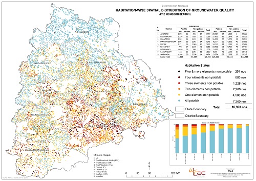
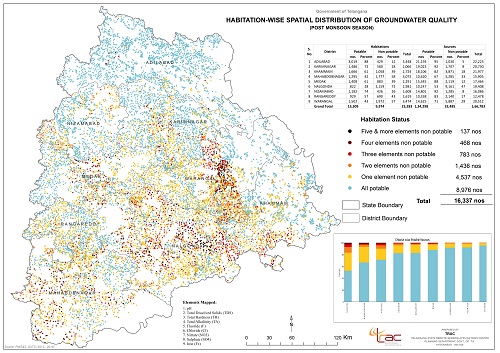
- Preparation of ground water quality layer on 1:50,000 scale and mapping the status of ground water quality with respect to its suitability for human consumption at a given point of time.
Output:
- Element wise and integrated ground water quality maps showing spatial and temporal distribution for 9 elements depicting suitability for human consumption.
- DSS for recharge or to take alternate drinking water source
- Regional / State Ground water quality map
- Ground water quality map corresponding to SoI toposheet on 1:50,000 scale up to habitation level
Drinking water supply schemes may be managed sustainably by using the applications of RS & GIS technology. GIS helps in monitoring the status of habitations, for selecting site specific locations, studying regional water quality monitoring, to know up to date status of the water quality affected habitations and to alert the administration / local community for taking alternate remedial measures.